CB Wetlands & Environmental Specialists is Restoring the Belcher Street Marsh
Projects Sponsor

Delta Management Group is the leading sustainability, ESG and clean tech focused search firm in Canada. Delta is proud to have founded the Canada's Clean50 Award program in 2011, and has been the primary sponsor for the past 13 years.
The Belcher Street Marsh is located on the macrotidal Jijuktu’kwejk River, part of the Bay of Fundy’s Minas Basin. An estimated 80% of the historic tidal wetlands in the bay have been lost since the introduction of dyking in the 17th century. The current 240 km of modern dyke infrastructure are maintained by the Nova Scotia Department of Agriculture (NSDA) and mainly protect agricultural land, as well as public infrastructure, cultural assets, coastal communities, and commercial properties. The dyke system is costly and labour-intensive to maintain and upgrade in the face of climate change.
Luckily, CB Wetlands & Environmental Specialists has stepped up to the rather soggy plate to go to bat for this vital ecosystem and infrastructure.
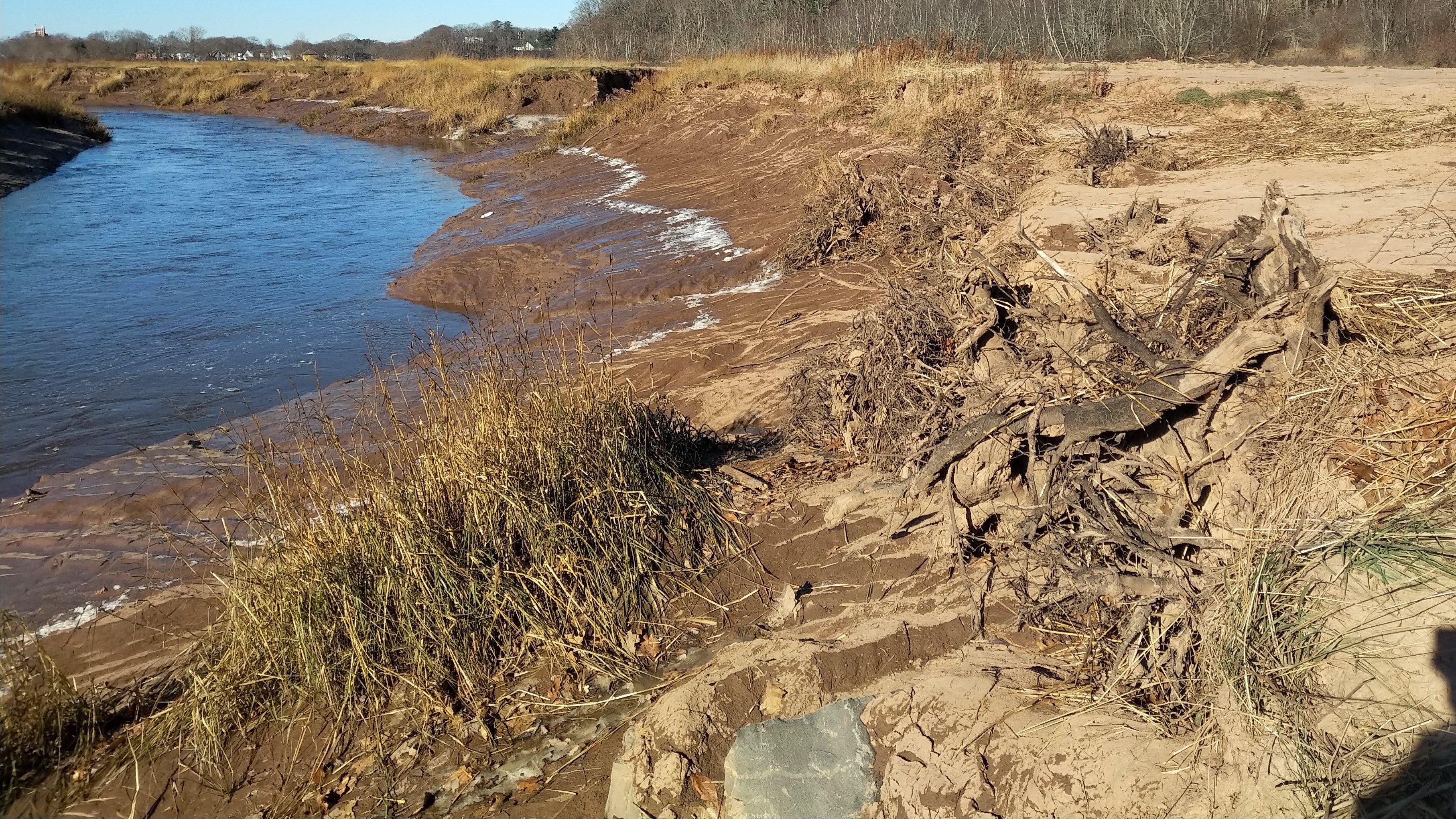
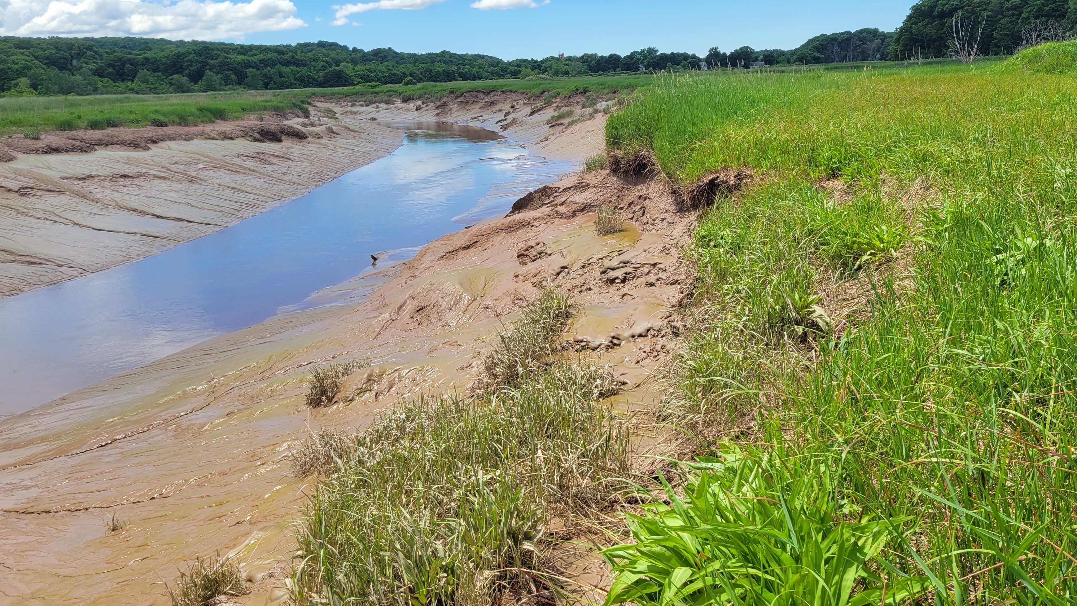
At the project site, there were several areas where the foreshore marsh had completely disappeared. Without this natural “first line of defence” and the space to accommodate rising water levels, the dyke was already experiencing severe erosion and was at imminent risk of failure, potentially resulting in significant damage to the agricultural lands it protected. An innovative approach to ensure the protection of the highest-value parts of the agricultural landscape was needed.
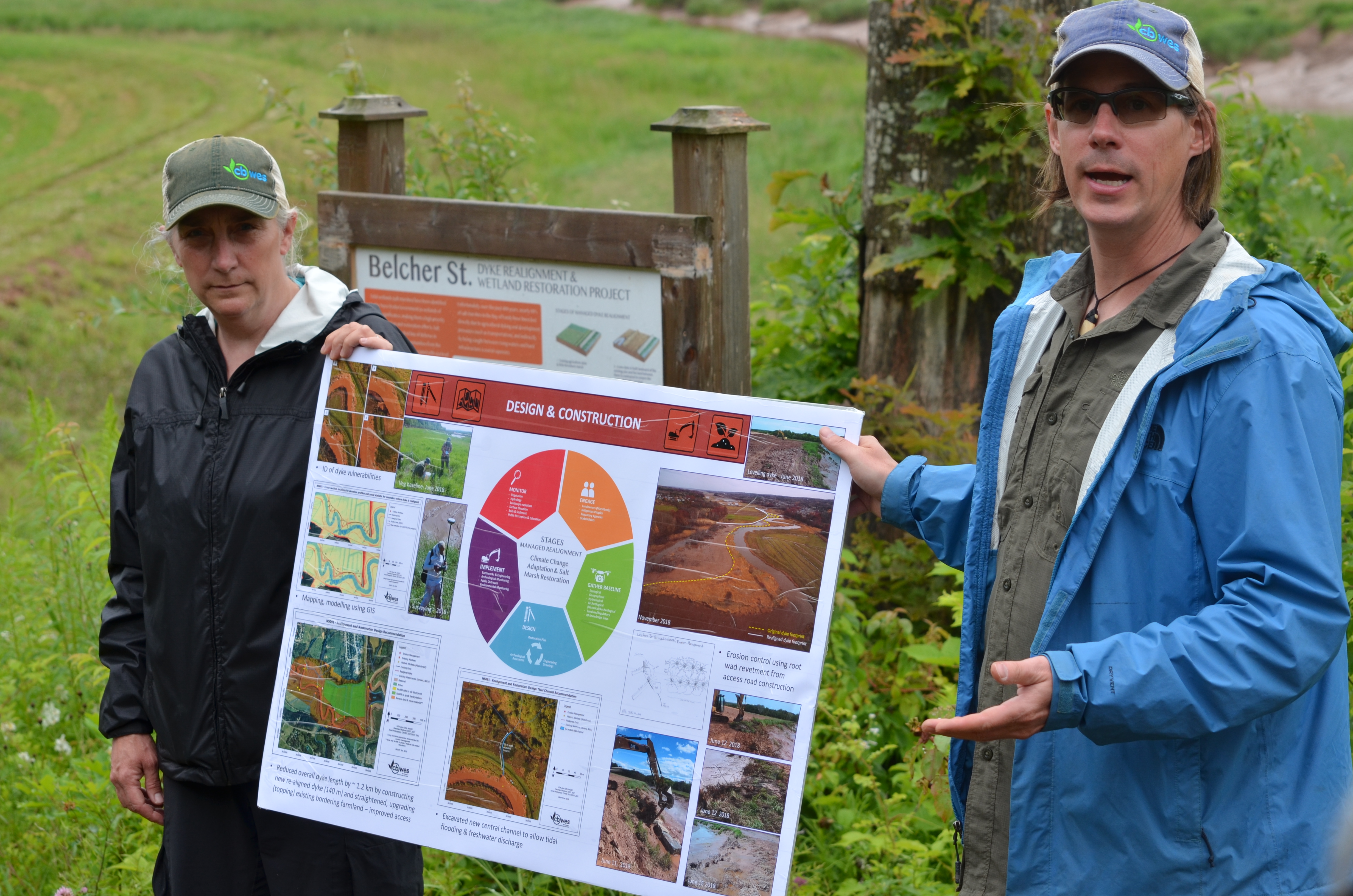
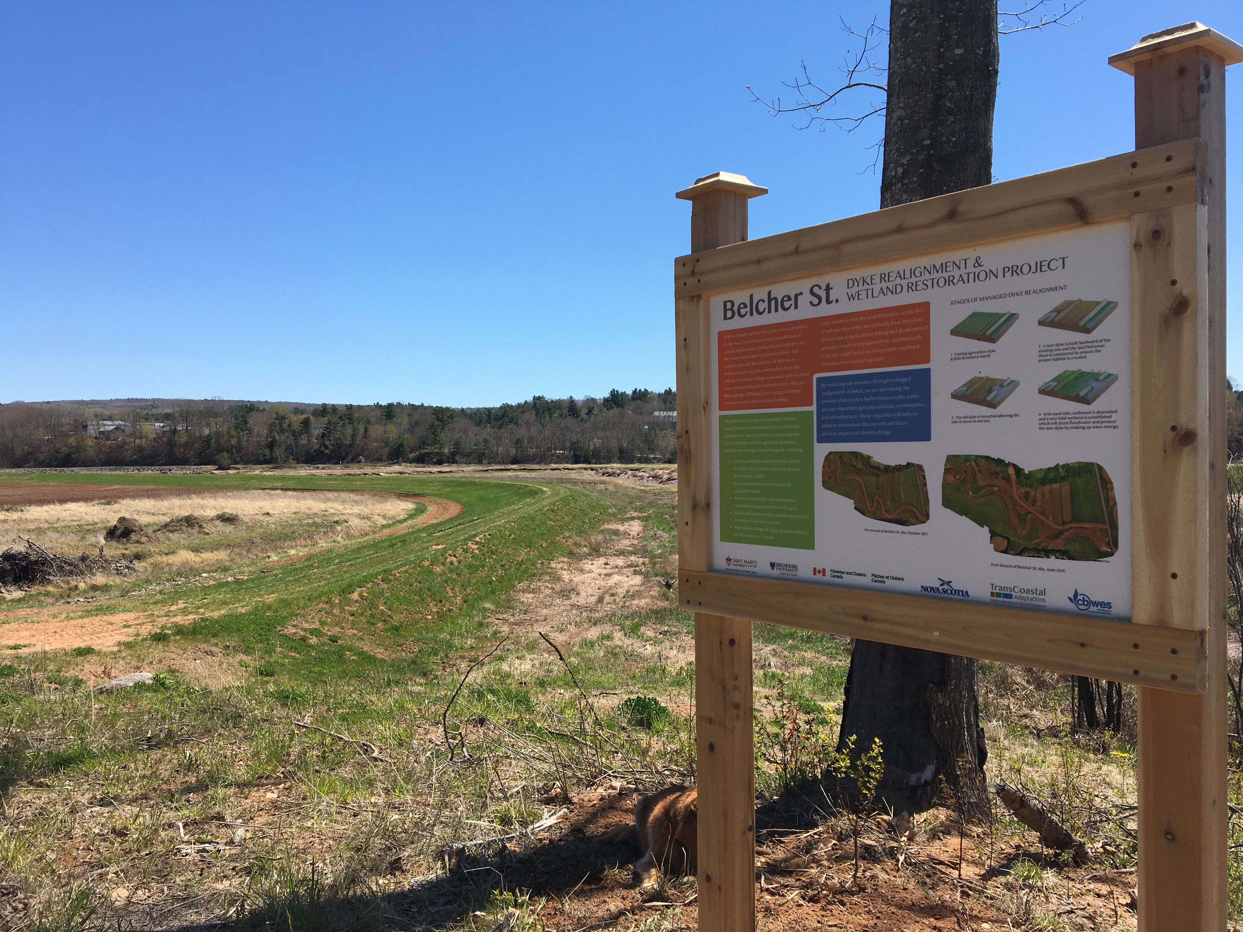
The 1.3 km tract of aging and increasingly eroding dyke infrastructure protecting 22.6 ha of agricultural land, most of which was actively farmed, was at risk of failure. Initiated by the NSDA, the collaborative team at CBWES and Saint Mary’s University set out to design and implement a managed dyke realignment and tidal wetland restoration project. The project goals were to reduce the amount of vulnerable dyke infrastructure at the site; improve the level of protection for the core portion of the high-value farmland; and restore nearly 10 ha of tidal wetland habitat. Additional benefits of the project included contributing to the climate change readiness and resiliency of the Jijuktu’kwejk River, reducing the flood risk to surrounding farmlands and communities, and serving as a living laboratory for research and public education. This project is an example of a cost-effective and nature-based dykeland management strategy, and is an alternative to the traditional “hold the line” approach.
A feasibility and design study was conducted, including the development of a pre- and post-restoration monitoring program that would be used to document changing habitat conditions, evaluate the impacts of restored tidal flow, assess the need for additional intervention, and determine the ecological benefits of restoration. Baseline monitoring was conducted between October 2017 and February 2018 and involved collecting data on tidal wetland indicators including geospatial attributes, hydrology, sediments, and vegetation.
Historical aerial imagery and archaeological assessment provided a preliminary historical context for the site. Historical imagery analysis showed that pooling on the western edge of the site had become more pronounced from 2008-2015. Plant community composition in the unmaintained western portion of the site leaned towards non-agricultural terrestrial and freshwater emergent species. Habitat mapping indicated that the drainage ditch was not actively maintained, and the western portion had degenerated to low-quality freshwater wetland. The deteriorating conditions of this portion of the dykeland presented a growing risk of drainage issues and biological risk to crops for the farmers, as well as increased the level of dyke vulnerability, and created an increasing source of greenhouse gas emissions due to poorly drained soil.
With the situation understood, it was time to get to work. Making Room for Wetlands managed dyke realignment and tidal wetland restoration projects generally follow five stages: engage, gather baseline, design, implement, and monitor. Once the team had engaged with key partners and communities, completed the site assessment, and solidified a design, it was time to implement the final design. The recommended design for this site included two nature-based techniques – managed dyke realignment to allow tidal wetland restoration and a hybrid living shoreline to address erosion concerns.
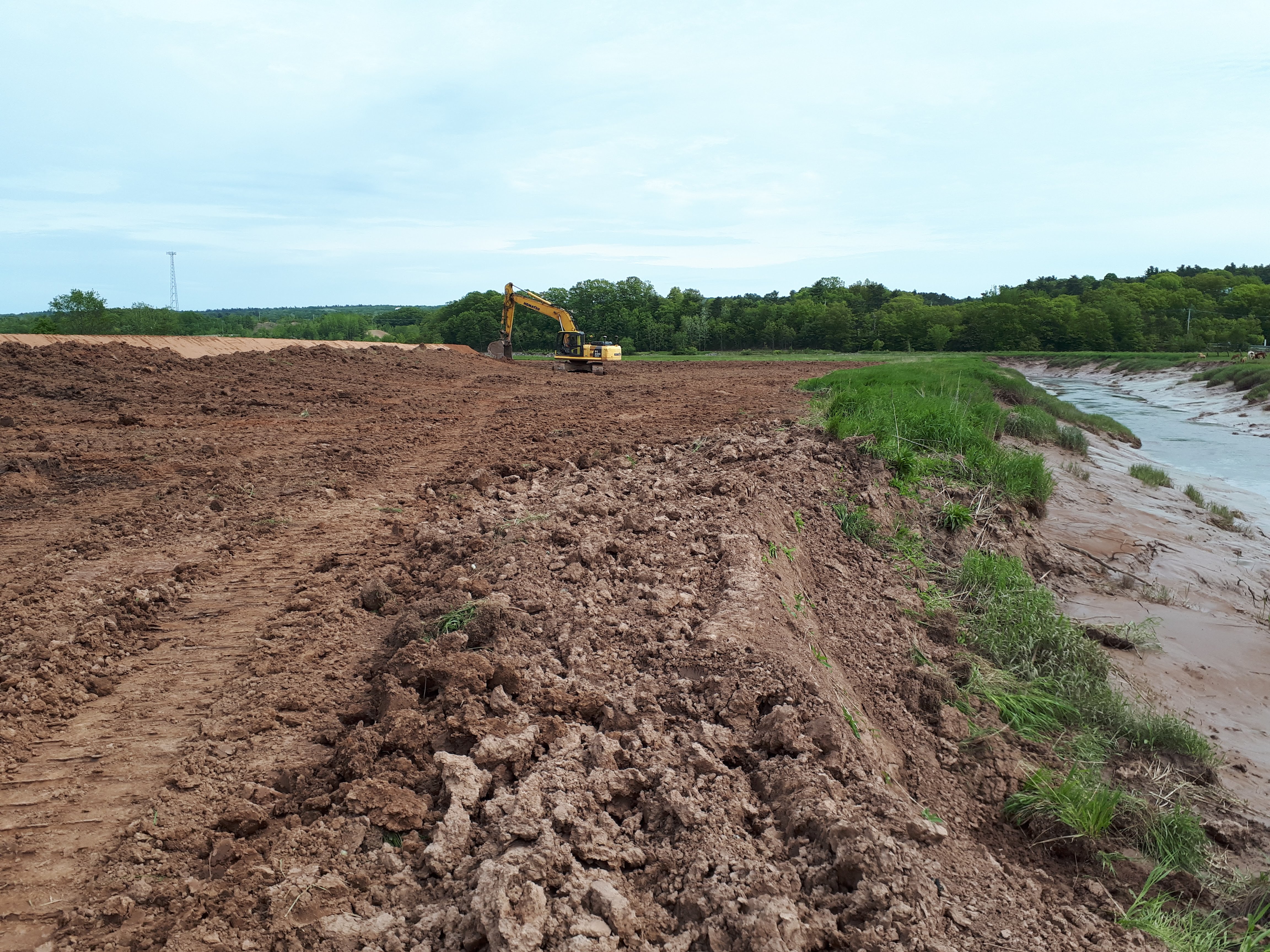
In June 2018, CBWES broke ground at the site. The section of dyke protecting the actively farmed land and road infrastructure was realigned and a new dyke tract was built at the western edge. This widened the foreshore marsh in front of the newly realigned tract of dyke. The new sections of dyke were built to the appropriate height to accommodate 2050 sea-level rise projections. The old dyke on the western edge was breached and levelled to remove tidal restriction, ultimately reducing the length of remaining dyke infrastructure by 500 m. A new tidal channel was created to allow for improved tidal flow and fish access to the interior of the site, as well as to divert freshwater flow away from the agricultural area.
As the site had already been experiencing severe erosion, the design included a hybrid living shoreline at one area of particular concern, to both slow erosion and protect the dyke without the use of ecologically detrimental hard armouring. This natural shield was created by installing inverted root wads and planting native salt-tolerant vegetation.
Once construction was complete, and the first tides returned to the site, the team could sit down, lean back and—keep up the good work. The post-restoration monitoring phase had begun and their new focus was collecting data for the next 6 years to determine the site’s trajectory long-term, and keeping an eye out for any “surprises” that mother nature may throw at the project.
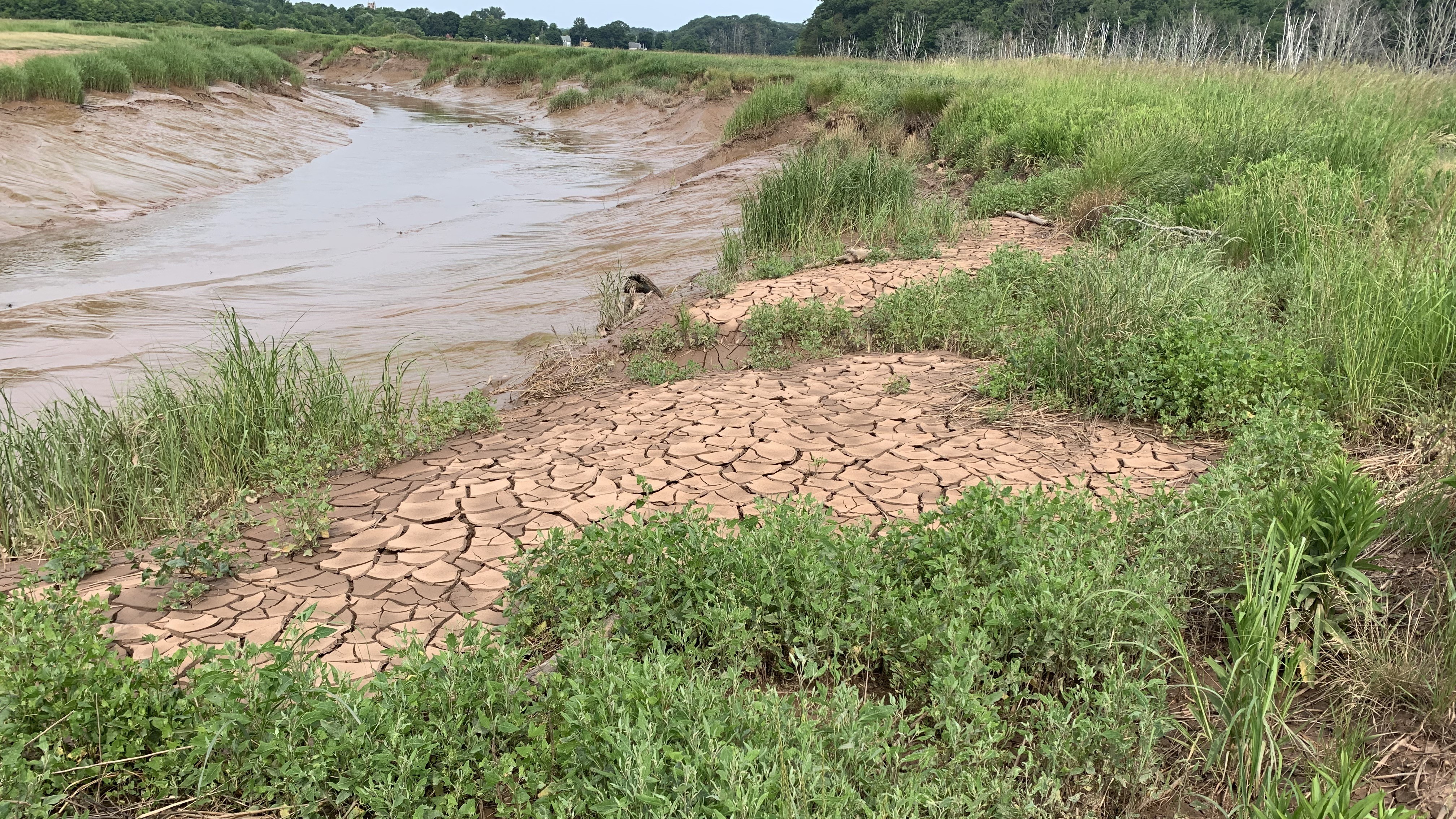
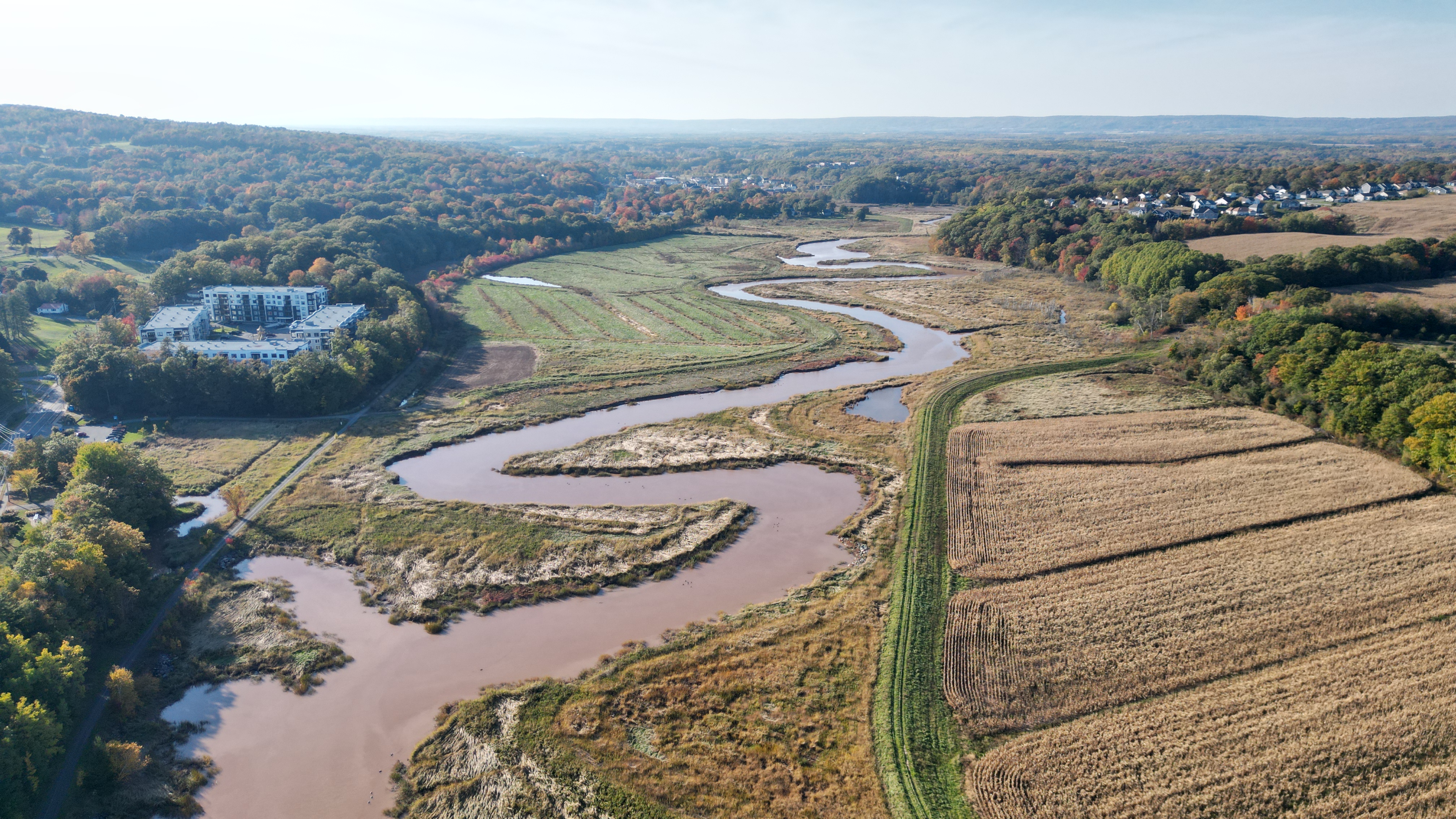
Five years of still-ongoing monitoring later the Belcher Street Marsh is now a thriving tidal wetland. The site has shown a net positive rate of accretion and elevation and is successfully keeping pace with sea-level rise. The tidal signal for the site shows that the water level within the site is equivalent to the signal in the river. This means that there is no tidal restriction, and full hydrological restoration has been successful. Aerial imagery over time has allowed the team to observe the continued development of the excavated tidal channel, as well as the overall vegetation cover at the site.
Plots looking at vegetation composition, abundance and height, showed a predictable die back of the pre-restoration vegetation, leaving large areas of bare ground in year 1. This was followed by rapid revegetation by salt-tolerant plants. By year 3, there was only 5% visible bare ground, and by year 4, only 3% bare ground was visible. By year 5, the living shoreline continues to evolve and adapt to changing conditions within the restoration site and the river, demonstrating the viability and flexibility of the technique compared to traditional hard armouring.
Throughout the implementation and monitoring, the Belcher Street Marsh has been a magnet for student research projects in social perception, archaeology, ecology, and more. The marsh has also played host to educational tours for the public as well as for practitioners, government officials, and as parts of conferences, demonstrating the potential for future nature-based solutions.
But perhaps even more important than the success the monitoring program has shown was the issues it helped the team recognize and address early.
As the Belcher Street Marsh adjusted to its new condition, there were two areas that were identified for adaptive management efforts. In the first summer post-restoration it was identified that rills were developing and causing scouring as water was preferentially draining over the living shoreline, possibly caused by soil compaction during the construction. To address the issue, CBWES implemented multiple nature-based techniques including filling in the eroded areas around the root wads with small evergreen trees, installing wattle and silt fencing and vegetation mats to slow the flow of water and increase the elevation of the area, and planting native vegetation. Today, the living shoreline appears stable.
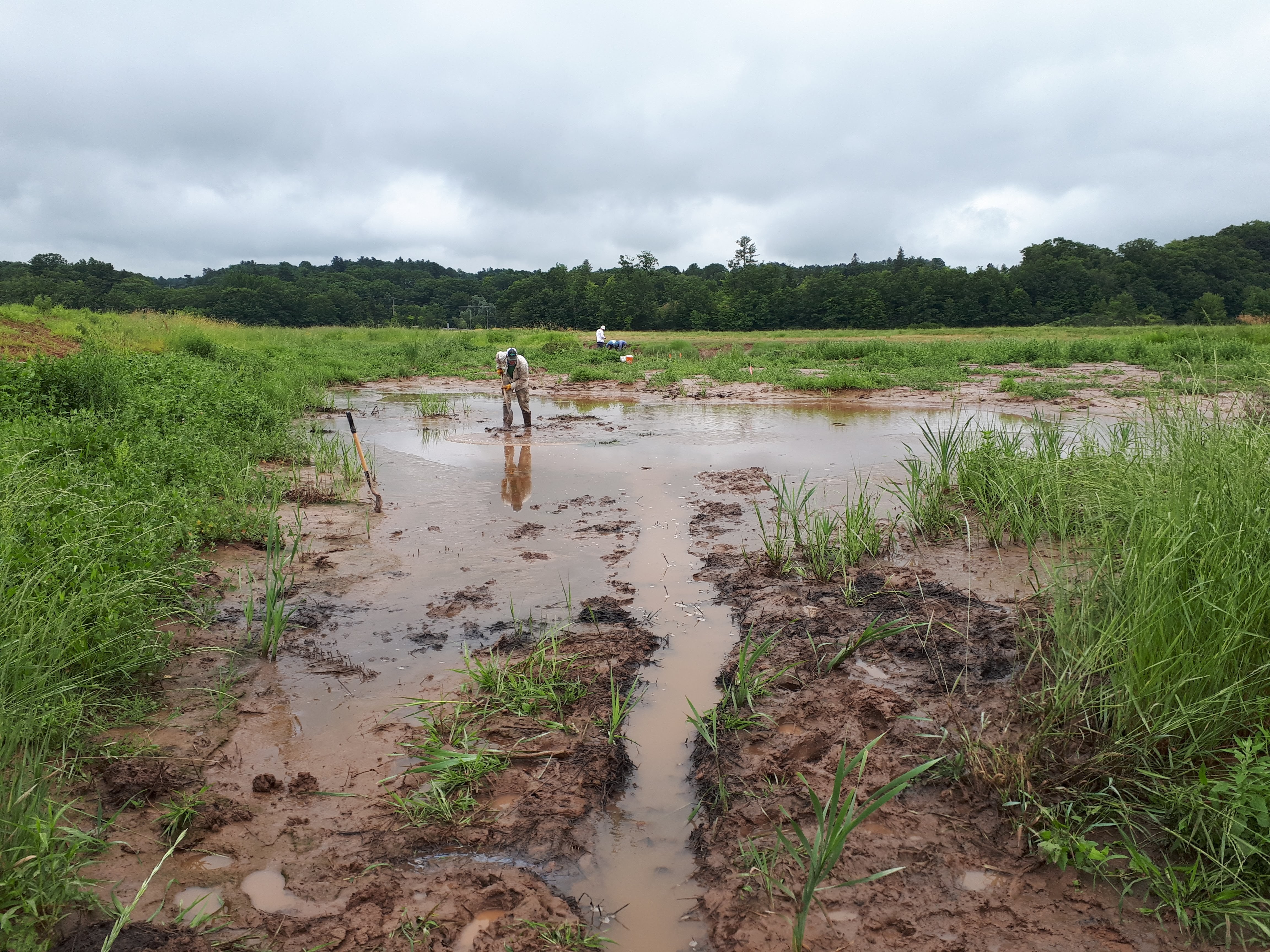
Another issue discovered was an area of ponded water near the toe of the dyke, likely present before construction, but cut off from drainage during construction. While areas of standing water are a natural part of wetland ecosystems, there were concerns about the effect of the ponding on the dyke. To reduce the ponding, the team hand-dug runnels to connect the area to the drainage network. While the ponded area still flooded during the highest tides, it now drained more effectively and revegetated, ultimately improving soil stability and reducing risk to the dyke.
This project is the first time that a hybrid living shoreline design has been implemented in combination with a managed dyke realignment and tidal wetland restoration project in Nova Scotia, and reminds us of the need for creativity, as the Making Room for Wetlands project continues into its next stage. This alternative approach to dykeland management was beneficial for all involved, providing the landowners protection for their important agricultural lands, restoring foreshore marsh habitat, and reducing the risk of flooding and erosion to dyke infrastructure, while also providing additional improvements to habitat and biodiversity and opportunities for learning.
Initiated by the Nova Scotia Department of Agriculture and carried out by the team of CBWES and collaborator Saint Mary’s University, the Belcher Street Marsh is a shining example of how creative collaboration can produce climate solutions that fit diverse needs – and it’s impossible to say this without getting just a little bit mushy.