Industrial Footprint Clean Up & Restoration for Climate
Projects Sponsor

Delta Management Group is the leading sustainability, ESG and clean tech focused search firm in Canada. Delta is proud to have founded the Canada's Clean50 Award program in 2011, and has been the primary sponsor for the past 13 years.
More than 500,000 oil and gas wells dot the Canadian landscape, and many carry a different story: some still produce, others quietly leak into the land around them. This project built a framework for telling the two apart, layering production data, reserve estimates and ecological indicators to identify which sites should be prioritized for cleanup under existing land stewardship law. The work helped launch a coalition of landowners, scientists, lawyers and Indigenous rights advocates pushing for enforcement of polluter-pay rules and regulatory transparency. Recommendations to licensees, governments and investors are due by year’s end, patient, unglamorous groundwork making sure that the stories about industrial legacy get a happy ending.
Canada has more than 500,000 oil and gas wells, plus the pipelines, facilities and roughly 130,000 soccer fields of oil sands mining that come with them, and no consistent, public method for deciding which sites to close first. Reversing biodiversity loss and protecting freshwater at scale means prioritizing industrial site restoration and knowing which wells are still worth producing and which are mostly sitting there leaking liability into the ground. This project set out to build that missing framework, drawing on more than 25 years of oil and gas development and environmental liability experience across Northeast British Columbia, Alberta and Southeast Saskatchewan.
The work began at the 2022 GeoConvention, where a presentation on the role of geoscience in liability management surfaced an uncomfortable gap: plenty of people were measuring the scale of Canada’s industrial footprint, but almost nobody was translating that measurement into a usable closure priority list. Dr. Brad Stelfox had already built a cumulative impact database mapping the industrial footprint, and the Alberta Biodiversity Monitoring Institute maintained ecological markers useful for identifying restoration priorities. What was missing was the connective layer, a method for weighing a well’s production rate and remaining reserves against the ecological harm it was causing, so that sites genuinely worth preserving could be told apart from sites that were mostly just polluting.
The project moved through it in phases. Phase 1 was public education: using a podcast and town halls to lay out the sheer size of the problem, the wells, the pipelines, the oil sands footprint, and over 1.8 trillion litres of contaminated tailings pond water sitting in the landscape, in terms people outside the industry could actually follow. That groundwork is done, and it’s what made the next phase possible.
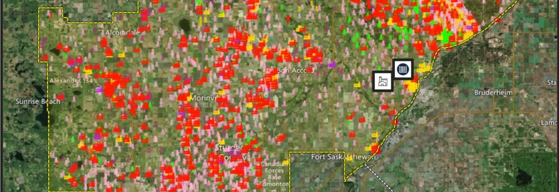
Phase 2 is underway now. Since 2022, the search has been on for anyone else building a public, user-friendly tool that maps environmental liabilities against reserve data, down to the level of individual production fluid breakdowns, and the search kept coming up empty. With no one else doing that work, the project is now building the website itself: a public mapping tool pulling together liability and reserve information so licensees, regulators and ordinary Albertans can see the same picture at once. It’s slated to launch by the end of 2026.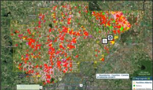
The biggest obstacles are misinformation and data fragmentation, rather than any technical gap in the data itself. A persistent public belief in Alberta holds that the province’s polluter-pay system has already failed and taxpayers are stuck covering the bill, when the entire purpose of Canada’s orphan well program, a structure unique among oil and gas jurisdictions, is to keep industry on the hook for cleanup liabilities even through bankruptcy. Correcting that misunderstanding, one town hall and one watershed council meeting at a time, has proven just as necessary as refining the underlying restoration model. Simultaneously, the data required to make essential water and land system function decisions is fragmented by discipline between governments, regulators, industries and the public (rights holders and stakeholders).
Phase 3 is coming and already taking shape. Once the mapping tool is live, the next step is folding in the Alberta Biodiversity Monitoring Institute’s ecological data alongside Dr. Brad Stelfox’s cumulative impact work, building both directly into the industrial infrastructure and reserve database so ecological harm and production value can finally be weighed side by side. That prioritization work is already underway through a seat on the Technical Steering Advisory Committee, where the case for folding ecological data into the model is actively being made.
The single biggest obstacle has been misinformation rather than any technical gap in the data itself. A persistent public belief in Alberta holds that the province’s polluter-pay system has already failed and taxpayers are stuck covering the bill, when the entire purpose of Canada’s orphan well program, a structure unique among oil and gas jurisdictions, is to keep industry on the hook for cleanup liabilities even through bankruptcy. Correcting that misunderstanding, one town hall and one watershed council meeting at a time, has proven just as necessary as refining the underlying restoration model.
None of the analysis happened in isolation. It drew on determining present land stewardship recommendations using the cumulative impact research from Dr. Brad Stelfox, ecological monitoring data from the Alberta Biodiversity Monitoring Institute, and ongoing collaboration and coalition building with Indigenous, landowners, scientists, lawyers and environmental organizations working across Alberta’s energy and land-stewardship landscape. Public outreach has run alongside the technical work from the start, using a podcast and town halls to put the scale of the problem in terms non-specialists can absorb rather than leaving it buried in regulatory filings and reserve reports few outside the industry ever read.
The framework’s value lies specifically in what it refuses to do: it won’t treat every well as equally deserving of continued operation, and it won’t treat every well as equally responsible for the region’s ecological decline. Once the mapping tool is public and the ecological data is folded in, the goal is a model that scores sites on the combination of how much they still produce and how much ecological harm they’re causing in the meantime, giving licensees, regulators and investors something a blanket closure mandate never could: a defensible, data-driven order in which to act.
What sets this project apart is that almost nobody else is doing the specific work of high-grading oil and gas sites for closure against ecological and legal criteria at the same time. Plenty of researchers can describe the scale of the problem; far fewer are building the analytical bridge from that description to an actual closure sequence licensees and regulators can follow. The bet underneath all of it is straightforward: restoration done in the right order, starting with the sites doing the most harm for the least remaining benefit, could become a genuine industry in its own right, one capable of employing people across the country for the better part of a century while quietly rebuilding the freshwater systems the original extraction put at risk in the first place.