Largest Individually-owned Conservation Project in Canada
Projects Sponsor

Delta Management Group is the leading sustainability, ESG and clean tech focused search firm in Canada. Delta is proud to have founded the Canada's Clean50 Award program in 2011, and has been the primary sponsor for the past 13 years.
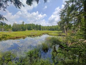
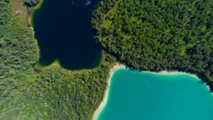
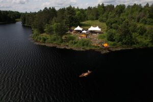
With support from the Ontario Conservation Accelerator, 26,300 acres of forest, wetlands, and lakes south of Bancroft, Ontario have now been formally recognized by the Governments of Ontario and Canada as a protected area. This property, known as The Park, is now the largest individually-owned protected area in Canada, and contributes to Canada’s 30×30 conservation target. The landowner, Ben Samann, with support from partners, manages the land for its biodiversity values, access for low-impact recreation and cultural practices, and research. The project serves as a scalable and inspirational model, demonstrating how private landowners can contribute meaningfully to conservation.
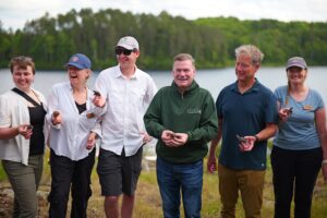
In 2021, with the support from Kristyn Ferguson, Managing Director of the Ontario Conservation Accelerator (OCA), Ben Samann, a private citizen and sole owner/operator of the company Land’escapes acquired a 26,300 acre property, known as The Park from the U.S. based forestry company and it’s a good thing too.
 Had Samann not acquired the land it likely would have continued to be used for aggressive forestry practices or sold off in pieces for cottage development, and things would have gone pretty differently. Without him, and the OCA, The Park project, which conserves the land, would not have been possible. Conservation organizations don’t generally have tens of millions of dollars on hand to acquire conservation lands. The major fundraising campaigns necessary to try and raise that kind of money can slow the pace of other critical conservation work. Philanthropists and conservation enthusiasts who are both keen, and have the means to buy and protect a large tract of land, don’t grow on trees, but fortunately for everyone here today, and generations to come, Samann was there for the long haul.
A footnote to the project is that Samann’s grandfather, inspired by the smell of pine trees in the Bancroft area, invented “Little Trees” air fresheners. His deep appreciation for the actual trees, and all the property’s natural values, made Samann determined to see the land protected in perpetuity. Yet he wanted to continue to own and manage the property during his lifetime.
Ferguson and Samann had found the property by conducting a scan of large tracts of private lands across southern and central Ontario. This parcel stood out as one of the largest remaining intact properties – second only to the Haliburton Forest and Wildlife Reserve in size—making it a truly rare opportunity for meaningful landscape-scale conservation.
 Its location makes it particularly important: the land sits at the intersection of two major biodiversity corridors – the Algonquin to Adirondack corridor and the Land Between corridor. These areas are widely recognized as ecological hotspots, rich in species diversity and vital to regional connectivity.
After acquiring the property through strategic negotiations with the former owners, Samann engaged a number of key partners, including the OCA, Blazing Star Environmental, the University of Guelph, and members of Curve Lake First Nation to conduct studies and complete plans for the property’s long-term management. Collectively the team has conducted extensive on-the-ground work including detailed habitat and species inventories which have mapped over 5,000 acres of wetlands, and at least 13 species at risk, sustainable forest management planning, lake health studies, and Indigenous engagement planning for ongoing use and cultural practices.
Creating a property management plan that acknowledged the sometimes-competing values of recreational access, Indigenous access, habitat management for species with competing needs (e.g. reforestation vs. maintenance of open habitat) was no small feat. Monitoring a property of this size vs. prioritizing hands-on stewardship work took negotiation between OCA and Samann. Research into various options and best practices, and a recognition of the fluidity needed for adaptive property management over time took time.
 Time was also spent considering the suite of land conservation tools available in Canada. These included acquisition of title (via purchase or donation) and conservation easements but, after careful review, it was determined that an emerging conservation tool known as recognition was the best way to achieve this landmark conservation goal.
The Park project presented an excellent opportunity to showcase how recognition works, encouraging its use across Ontario, Canada and other countries who are yet to adopt it, including the U.S.
To make recognition happen the team assembled the necessary documents to showcase how the land is providing durable, long-term, tangible and measurable benefits for nature and biodiversity outcomes. These included maps showing the municipal zoning, recognizing environmentally sensitive and significant wildlife areas within the property and the conservation-focused property management plan. Evidence of the aforementioned long-term partnerships for monitoring, stewardship, research, and evidence of long-term planning for the property’s ownership beyond the life of the current owner were also submitted.
The team worked with the Government of Ontario to complete the Decision Support Tool Screening Template for the property, carefully validating the ways in which its long-term conservation will be ensured. The Ontario Conservation Accelerator characterized the property using detailed mapping of boundaries and internal mapping of habitats, along with providing highlights from the extensive species inventories that had been conducted.
Completing the paperwork and mapping to support a protected area recognition project is no small feat. Fortunately, Ferguson’s deep knowledge of the process earned throughout her conservation career, equipped her well for the task. Her understanding of the likely pitfalls and her relationships with government staff helped the team work through the challenges—and there were lots of challenges. Almost every section of the Decision Support Tool Screening Template submitted was scrutinized, questioned, and challenged.
The project had its outright naysayers as well with some calling it, “conservation accounting” There was concern that pieces of the “stack” of mechanisms that prove that the land is functioning as a protected area and will for the long term are fallible (e.g. “”what if Samann decides to sell the land tomorrow?””).
The OCA team and Samann worked hard to think through these questions and provide responses that provide assurance but also recognize the inherent uncertainty in all things. It proved to be a significant education opportunity for conservation inner and outer circles.
Once recognition of the land as a protected area was approved by the Government of Ontario, the proposal was elevated to the Government of Canada who also green-lit the status and included it in the Canadian Protected and Conserved Areas Database where it is now viewable.
At 26,300 acres, this is a record-setting act of private conservation in Canada, recognizing the protection of thousands of hectares of critical habitat and supporting national biodiversity goals while demonstrating the potential of an underutilized conservation tool. It’s proof that individuals (not just governments or NGOs) can lead science-based, legally binding, and lasting conservation efforts.
The project produced shareable documents (the Decision Support Tool, mapping files, and “stack” of conservation mechanisms to back up the recognition) that can be easily disseminated and adapted. As well, the OCA team, eager—as are the Ontario and federal governments— to encourage others to have their natural lands recognized, are standing by.
All proving that sometimes, with a little effort and the right partnerships, you can see—and keep—the forest for the trees.