Ocean Sensor Innovation Platforms (OSIP): Building the Evidence Pathway for Responsible Tidal Deployment
Projects Sponsor

Delta Management Group is the leading sustainability, ESG and clean tech focused search firm in Canada. Delta is proud to have founded the Canada's Clean50 Award program in 2011, and has been the primary sponsor for the past 13 years.
Tidal energy development in Canada stalled in 2023 for lack of a regulatory pathway that both scaled and earned trust, so OSIP set out to build one. Conceived in response to the 2024 federal Tidal Task Force’s call for new research, the project unites multiple partners and global experts to test next-generation monitoring in the Bay of Fundy’s Minas Passage. Its research has already supported Canada’s first staged approval for tidal devices, first up to three Orbital O2-X units, and since increased to six. With a subsea platform already collecting data and a floating platform launching in fall 2026, OSIP is helping bring Canada’s tidal sector back with the tide.
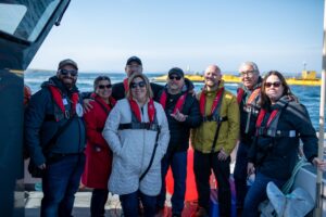
Tidal development in Canada had effectively stalled by 2023. Sustainable Marine had withdrawn from the Bay of Fundy, and the companies still interested in the world’s most powerful tides had a simple problem: there was no clear regulatory path from a single device to a working array, and without that path, investors weren’t willing to bet on it. The Ocean Sensor Innovation Platforms project, OSIP, set out to build the evidence base Canada needed to move tidal energy forward responsibly. Its research has already helped secure the country’s first staged approval under a new regulatory framework, for up to three tidal devices at the FORCE site in Minas Passage, since expanded to a license for six.
The gaps OSIP helped fill were both regulatory and technical. In response to the stalled sector, the federal Task Force on Sustainable Tidal Energy Development recommended a revised, staged approach to Fisheries Act authorizations: projects could begin with limited deployment and comprehensive monitoring, with evidence from early phases informing decisions about the devices that followed. Fisheries and Oceans Canada solved one problem by building that approach but another remained. Minas Passage runs currents that can exceed five metres per second with turbidity that severely limits visibility, and nobody yet knew what monitoring tools, methods and data would actually be reliable enough to support real decisions in conditions that extreme. Lindsay Bennett led FORCE’s effort to answer that question, working with Acadia University through 2024 to map a shared research and monitoring model built directly around the Task Force’s recommendations. The project was announced with $8.2 million in Natural Resources Canada funding in September 2025.
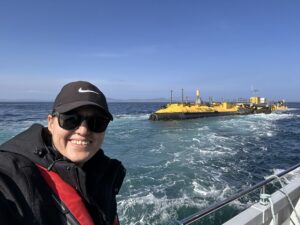
OSIP wasn’t starting from nothing. It builds on more than 15 years of environmental monitoring at the FORCE site, covering fish tracking, hydroacoustic surveys, marine-mammal monitoring and the development of earlier subsea platforms for the Passage’s extreme conditions. The project was also shaped directly by the Task Force’s own Risk and Monitoring Working Group, co-chaired by Bennett and Acadia’s Dr. Anna Redden, which found that no single sensor or dataset could answer every question about fish-turbine interaction risk on its own. Cameras can be limited by turbidity and lighting; imaging sonars work in poor visibility but require careful interpretation; acoustic telemetry track tagged animals across wide areas but can’t detect every fish. Reliable monitoring meant testing multiple technologies together, under the real conditions tidal devices would actually operate in, not a lab or a calmer stretch of water somewhere else.
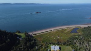
Building that shared field laboratory started with the partnership itself. Acadia University became the central scientific partner, while the Confederacy of Mi’kmaw Nations brought Mi’kmaw knowledge and Rights Holder perspectives into the monitoring priorities from the outset, supported by the Atlantic Policy Congress of First Nations Chiefs Secretariat, the Assembly of Nova Scotia Mi’kmaw Chiefs and Kwilmu’kw Maw-klusuaqn. Canadian organizations contributed expertise in acoustic telemetry, fish tracking and sensor integration, while international researchers from the United States, Scotland and the global tidal energy industry brought experience from other marine energy sites. The structure was deliberate: OSIP wasn’t set up to test equipment for its own sake, but to test whether monitoring approaches actually meet the needs of regulators and the people who live, work and depend on the Bay of Fundy.
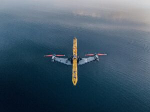
With the partnership in place, FORCE designed two complementary pieces of reconfigurable infrastructure: a subsea platform on the seafloor testing instruments looking up through the water column, and a floating surface platform providing deck space, power and mounting positions for instruments looking down. Vessel-based trials evaluated camera systems, lighting and sensor configurations at different depths before any platform deployment, and the subsea platform has since launched at FORCE and is now collecting real data under live conditions. For the floating platform, FORCE chose not to build an entirely new structure from scratch, instead acquiring Sustainable Marine’s former PLAT-I tidal platform from reconcept Canada, a structure already engineered for the currents of Minas Passage. After structural repairs, protective coating, sensor integration and a new power system, it’s in final preparations for a controlled relaunch scheduled for fall 2026, when it will begin testing monitoring technologies at the site and transmitting data to shore wirelessly rather than waiting on lengthy equipment-recovery cycles.
None of this came easily. Testing reliable technology in one of the most difficult marine environments in the world for collecting dependable data meant accepting that no single instrument would provide a complete answer, and building platforms robust enough to combine several at once. Designing and fabricating an entirely new floating structure would have cost significant time and money the project didn’t have room for, which is exactly what made repurposing PLAT-I the right call rather than the fallback option. And coordinating a partnership this wide, spanning government, academia, Indigenous Knowledge Holders, marine operators and international researchers with genuinely different mandates and technical languages, meant FORCE had to serve as project integrator throughout, keeping everyone focused on a shared question: not just whether a sensor works, but whether the evidence it produces is actually useful to the people who have to make the call.
The results have already moved past the platforms themselves. Beyond the $8.2 million in federal investment and the subsea platform now collecting live data, OSIP’s Adaptive Environmental Effects Monitoring Program guidance directly supported Orbital Marine
Power’s successful Fisheries Act authorization application, the first issued under DFO’s revised staged framework, for up to three O2-X devices, within a broader licensed pathway now covering six – enough to power about 12,000 homes. The Confederacy of Mi’kmaw Nations completed a Mi’kmaq Ecological Knowledge Study to ensure monitoring approaches are genuinely informed by Indigenous Knowledge Systems alongside western science, an approach guided by Two-Eyed Seeing rather than one discipline standing in for the other. And because OSIP’s model, shared infrastructure, multiple synchronized sensors, open data, Rights Holder participation and research designed around actual regulatory decisions, is built to be replicable, its findings are relevant well beyond the Bay of Fundy, in any jurisdiction trying to develop marine energy responsibly in difficult water.
A regulatory pathway is only as good as the evidence that runs through it. OSIP spent two years building the instruments, the partnerships and the trust needed to make Canada’s staged approach to tidal energy actually work in practice, and the tide, for once, is moving in the right direction.